Showing posts sorted by relevance for query Khyber. Sort by date Show all posts

Thursday, 9 June 2011

Khyber Pass Pakistan

Khyber Pass

The Khyber Pass, (Pashto: د خیبر درہ, Urdu: درۂ خیبر) (altitude: 1,070 m or 3,510 ft) is a mountain pass linking Pakistan and Afghanistan.
The Pass was an integral part of the ancient Silk Road and throughout history, it has been an important trade route between Central Asia and South Asia and a strategic military location. The summit of the Khyber Pass is 5 kilometres (3.1 mi) inside Pakistan at Landi Kotal and it cuts through the northeastern part of the Safed Koh mountains which themselves are a far southeastern extension of the Hindu Kush range.


Origin of Name

According to historians and local oral traditions, Khyber is a word of Hebrew origin meaning a fort, castle or palace.
"Khyber is a Hebrew word, it means a fort". [1] [2]
"No one knows when Khyber got its present name, but this much is certain that "Khyber" is a word of Hebrew language and it means palace or castle. There is also a city and fort known as "Khaybar" Forty miles to the west of Medina (Saudi Arabia), which was inhabited by Jews before the rise of Islam, and was conquered by Muhammad in 629 AD..".


History

In some versions of the Aryan migration theory, the Indo-Aryans migrated to India via the Khyber Pass.[citation needed] Recorded invasions through the Khyber begin with the conquests of Darius I and Alexander the Great and also include later Muslim invasions of South Asia, culminating with the establishment of the Mughul Empire from 1526. The British invaded Afghanistan from India and fought three Afghan Wars in 1839-42, 1878-80, and 1919. George Molesworth, a member of the British force of 1919, summarised: "Every stone in the Khyber has been soaked in blood." Rudyard Kipling called it "a sword cut through the mountains."
Finally, Sikhs under Ranjit Singh, in 1798 brought to an end the 800 years of foreign invasions into India through Khyber Pass, by bringing it under their control. This was the best gift the Sikhs gave to the nation which finally allowed the rest of India to breathe in peace. Hari Singh Nalwa, who manned the Khyber pass for years became a household name in Afghanistan.
Afghan chiefs and a British Political officer posed at Jamrud fort at the mouth of the Khyber Pass in 1878.
To the north of the Khyber Pass lies the country of the Mullagori tribe. To the south is Afridi Tirah, while the inhabitants of villages in the Pass itself are Afridi clansmen. Throughout the centuries the Pashtun clans, particularly the Afridis and the Afghan Shinwaris, have regarded the Pass as their own preserve and have levied a toll on travellers for safe conduct. Since this has long been their main source of income, resistance to challenges to the Shinwaris' authority has often been fierce.
For strategic reasons, after the First World War the British built a heavily engineered railway through the Pass. The Khyber Pass Railway from Jamrud, near Peshawar, to the Afghan border near Landi Kotal was opened in 1925.
During World War II concrete "dragon’s teeth" (tank obstacles) were erected on the valley floor due to British fears of a German tank invasion of India.[4]
The Pass became widely known to thousands of Westerners and Japanese who travelled it in the days of the Hippie trail, taking a bus or car from Kabul to the Afghan border. At the Pakistani frontier post, travellers were advised not to wander away from the road, as the location was then a barely controlled Federally Administered Tribal Area. Then, after customs formalities, a quick daylight drive through the Pass was made. Monuments left by British Army units, as well as hillside forts, could be viewed from the highway.
The area of the Khyber Pass has been connected with a counterfeit arms industry, making various types of weapons known to gun collectors as Khyber Pass Copies, using local steel and blacksmiths' forges.[5][6]


Current conflicts

During the current war in Afghanistan, the Khyber Pass has been a major route for resupplying NATO forces in the Afghan theater of conflict. Recognizing this, the Taliban attempted to choke off the route in late 2008 and early 2009, bringing the Taliban into conflict with the Pakistani government.[7]
In February 2009, a bridge 15 miles northwest of Peshawar was blown up by militants presumably sympathetic to or sponsored by the Taliban. While it was not considered to be a major strategic blow to the allied war effort, it invigorated efforts to secure additional supply routes, some of which may ultimately run through Iran. However, the current general consensus is that the new supply route will pass through various central Asian republics to the north of Afghanistan.

Saturday, 7 May 2011

Galyat Pakistan

Galyat  

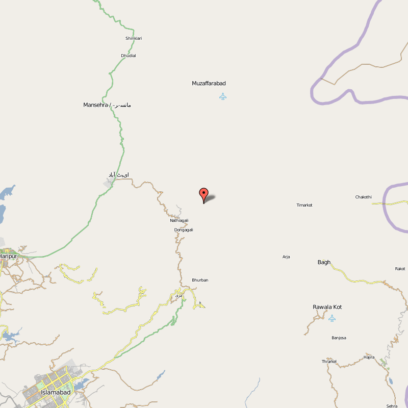
Galyat (Urdu: گلیات ) region is an area roughly 50–80 km north-east of Islamabad, Pakistan, on both sides of the Khyber Pakhtunkhwa-Punjab border.


The word Galyat is the plural of the Urdu word gali, which means an alley between two mountains on both sides of which there are valleys and it is not the highest point in the range. Many of the towns in the area have the word gali as part of their names. These are popular summer-holiday destinations in Pakistan. Murree, one of the most popular hill stations of Pakistan, is the largest town of the Galyat area.

Localities in the Galyat

Wednesday, 4 May 2011

Nathia Gali Pakistan

Nathia Gali

Nathia Gali or Nathiagali (Pashto: نتھیا گلی, Urdu: نتھیا گلی) is a mountain resort town or hill station in Hazara, Khyber Pakhtunkhwa, Pakistan. It is a part of the Galiaath which are termed such due to several hill-stations in that area ending with the word "gali", most of which are connected to one other. Nathiagali is known for its scenic beauty, hiking tracks and pleasant weather, which is much cooler than the rest of the Galiaath due to it being at a greater altitude. It is situated one hour's drive away from both Murree and Abbottabad, it lies midway between the two. Drive time from Islamabad is usually about two hours, unless there is a lot of traffic.[2]


Tourism

Nathia Gali town also serves as the administrative centre of Nathia Gali Union Council. It is located in Abbottabad District, Khyber Pakhtunkhwa. At 2,500 m (8,200 ft), it is a popular tourist resort in the summer months. It is forested with pine,cedar,oak walnut and also oak and maple trees.
During the summer, Nathiagali is relatively popular amongst tourists, but due to its limited size and availability of property, it is not thronged by as many people as the hill-station Murree, which is only an hour away.but nathiagali is to much peaceful and attractive for tourists regardng its beauty as compare to murree.
Accommodations are excellent in Nathiagali; hotels and resorts provide excellent quality accommodations equipped with all facilities. The most popular hotels are Green Retreat, Elites Hotel, Amore Hotel and many other hotels and rest houses. In summer their rates become very high.

Saturday, 21 May 2011

Torkham Pakistan

Torkham

Torkham (Pashto: طورخم Tūrkham) is a border crossing town in the Nangarhar province of Afghanistan and the Khyber Agency of Pakistan's Federally Administered Tribal Areas, right on the Durand Line border.[1][2][3] It is linked by a highway with Jalalabad to the west and Peshawar to the east, connecting with N-5 National Highway all the way to Karachi. The town is only five kilometres west of the summit of the Khyber Pass. Torkham is the busiest port of entry between Afghanistan and Pakistan. It is also a major transporting, shipping, and receiving site between the two neighboring countries.[4]
Torkham and the vast surrounding area is inhabited by ethnic Pashtun tribes or Pashtun people. In November 2001 the New York Times reported that Towr Kham was the home of Hazrat Ali, an anti-Taliban militia leader who seized power after the Taliban retreated.[2] The New York Times reported that Hazrati Ali had joined forces with two other militia leaders, Mawlawi Yunis Khalis, and Ezatullah, to set up a regional provisional government.
In April 2006 the Afghan Border Police announced that they would start requiring travelers crossing the border at Torkham to possess valid travel documents.[3][5]
Highway 1 connects Torkham to Kabul.[6]
American forces staff the nearby Towr Kham Fire Base.[7][8]
Torkham lies on the most important supply route for Western Forces in Afghanistan. Pakistan has used blocking supplies as a bargaining chip, for example as a reaction to Western Forces attacking targets in Pakistan for example in 2008[9] and 2010.


U.S. Army Sgt. Michael Espejo, 66th Military Police Company stationed out of Fort Lewis, Wash., pulls security at the Pakistani border at Torkham Gate during the Afghan Independence Day ceremonies, Aug. 19. U.S. Army

Railway


n 1891 the British extended the Indian Railways (now Pakistan Railways) to Torkham. The rails were not extended into Afghanistan to the north and west for political reasons. Over much of the last century, there have been proposals to extend the Torkham line to Afghanistan and possibly beyond, passing through Jalalabad. These proposals have the support of the current Afghan government. In July 2010, Pakistan and Afghanistan signed a Memorandum of understanding for going ahead with the laying of rail tracks between the two countries. Work on the proposed project is set to start in the next four months